Ancient Roads
Ancient roads have a fascination for me that is hard to analyse. It may be because they are a record of man's past travels or his struggles against nature, or because they lead through beautiful and remote countryside, but whatever the motive - and amateur psychologists are welcome to speculate - I love following ancient roads. At various times I have walked along the Pilgrim's Way in southern England, followed the Icknield Way, driven the length of Watling Street or gazed yearningly at the distant path of the Roman road over Bwlch y Ddau Faen - the Pass of the Two Stones, ancient menhirs that still straddle the less ancient road.
It seems that Steven Sidebotham and Ronald Zitterkopf of the University of Delaware share my fascination with roads, because during the four years between 1996 and 2000 they assiduously followed the path of a Roman road in Egypt.
If we have any interest in the subject we will have seen illustrations of how the Romans made their roads or photographs of some of those remaining roads - fragments of the Appian Way south of Rome or the fascinating rock-hewn tunnel that they bored through an outcrop in an Alpine Pass. We may even have seen an old photograph of the Roman road to Antioch in Syria, a line of stone blocks standing proud of the desert floor and snaking away into the distance. The road followed by the Delaware team was nothing like any of these.
Constructed around AD 137, the road was commissioned by the Emperor Hadrian following his visit to Egypt. On that journey the emperor had been accompanied by a large entourage which included his court poet - poetess - Balba, and his favourite, a good-looking youth by the name of Antinous. Unfortunately Antinous was sufficiently vain to attempt to see his own face reflected in the waters of the Nile by moonlight and, being somewhat tipsy at the time, managed to fall in and either could not swim or encountered a more than usually alert sacred crocodile. Overcome with grief, Hadrian ordered that a new city be founded in his memory.
Cities need a reason for their continued existence: a market, a trade route, the only spring for miles around, or whatever. Antinoopolis had no such raison d'etre and in order to furnish it with some means of livelihoood Hadrian ordered that a new road should be built linking the city on the east bank of the Nile with the Red Sea ports. The new road was the Via Nova Hadriana and ran for about 500 miles across the desert to the Red Sea and then south to the port of Berenike.
Roman records claim that the road was completely built, but the Delaware team's conclusion is that someone was being economical with the truth - quite possibly the engineers responsible for the road. Far from being a carefully laid Roman road, the Via Nova Hadriana was little more than a broad swathe of ground from which the stones had been carefully raked and left in piles on both sides. There were signs that the surveyors had done their work - little cairns mark out the route to be followed - but either the engineers were called to other work once Hadrian had died or they pocketed the greater part of the money budgetted for the work and relied on Hadrian never finding out that his beautiful road was a figment of his imagination.
The team notes that while the desert stretch of the road is undefended - the wells and rest-tops are unfortified - the part of the road running beside the Red Sea is well defended with frequent forts. There are, it seems to me, two reasons for this. In the first place the route along the shore was by no means new and the forts may well have grown up along the line of the previous route, even if it was not a formal road. The second reason is that the road along the shore was subject to raids by pirates landing from Arabia Felix and therefore in greater need of protection.
It may be for the same reason that for the greater part of its length the road lies well inland from the shore - as much as ten or twelve miles inland. The further away from the shore the laden caravans travelled, the less likely they were to be attacked. Another reason may be to do with water; wells could be sunk in the beds of wadis to make use of water that had come down with the winter rains but wells sunk too close to the shore risked being infiltrated by salt water.
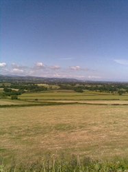
Unfortunately, despite the presence of those wells, the Via Nova Hadriana was not the most comfortable of routes. As those who have been on our tours can testify, the Red Sea shore is an arid, inhospitable route and weary travellers alighting from dhows in the Red Sea would have been eager to get to the cool waters of the Nile as swiftly as possible. Instead of marching for days along the dry, rocky shore and then turning inland to cross the even drier desert, why not get through the desert right away and then march through the fertile fields of the Nile Valley? Each of the Red Sea ports already had its road leading as directly as possible through some wadi or pass to the Nile Valley - that was why they had been established as ports - and so most travellers followed the age-old roads, leaving Hadrian's new road to those who knew no better.
It reminds me of the story of the architect who designed a college or university, but when the keys were handed over, the dismayed faculty discovered that there were no paths. When challenged the architect smiled enigmatically and said that they would be built "soon". Several months went by and students, rushing from one class to the next and from dormitories to dining rooms, wore their own paths across the grass as they found the most convenient routes. Six months later the architect turned up with a team of builders and laid concrete over these impromptu tracks.
Hadrian, if only he had been blessed with a time machine, could have profited from that architect's example.