The Pilgrim of Bordeaux
Because they lacked a compass, the Romans tended not to try and draw maps - which were, in any case, inconvenient things that contradicted the beautiful geometric ideas of the geographers. Strabo, for example, rejects the reports of travellers about certain distances because of his prior idea that Asia must be a perfect rectangle!
Instead the Romans drew up intineria or lists of places through which you would pass from A to B, together with distances. The Pilgrim of Bordeaux is just such an itinerary, listing the cities, the places where travellers could change horses (mutatio), and the halts (mansio)- which were usually inns where you could stop for the night and be protected from both bandits and the elements.
The document is known as The Pilgrim of Bordeaux for no other reason than that it starts in that city - Roman Bordigala. We know nothing whatsoever about the individual who drew it up, though clearly he (or she) must have traversed the route and visited the holy sites listed in Palestine. We do, however, know the date of his journey, because he mentions that it was made when Flavius Dalmatius and Domitius Zenophilus were joint consuls, which fixes it between May and December of AD 333.
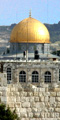
That means that a mere twenty-one years after Christianity was legalised, pilgrims were already heading for Jerusalem and an industry had sprung up to identify the holy places. The mendacity and inventiveness of the guides of that time is shown by the fact that our pilgrim speaks of Jesus' transfiguration as taking place on the summit of the Mount of Olives! Of course, Jerusalem had been so thoroughly destroyed by Hadrian and his city of Aelia Capitolina had obliterated all memory of where the sacred sites had been, so the guides had to do something to satisfy the eager pilgrims who were starting to pour into the city.
Along the way our pilgrim notes every provincial boundary, a few geographical features and a few important historical connections that he must have found interesting. We could wish that he had been more verbose, for there was much in his journey about which we would like to know more. For example, Constantinople had been laid out by the emperor three years before our pilgrim arrived there, yet we are told nothing about the frenetic building work that must have been going on as he passed through.
The Itinerary exists in four manuscripts, none earlier than the 8th century, some 500 years after the document was written. Two of the manuscripts only give the portion which describes the Holy Land.
Itineraria were written on long strips of papyrus or parchment and this is doubtless the form that the pilgrim's original document took. We have broken it up into four sections: Bordeaux to Constantinople, Constantinople to Jerusalem, around Jerusalem, and then back to Milan. This has been done solely for convenience.