Tour 6 - North from Jerusalem
Shiloh - Nablus - Jacob's Well - Samaria - Beth Shan - Ain Dor - Mt Tabor - Baptismal site - Tiberias - Galilee cruise - Magdala - 1st century boat - Mt of Blessing - Tabgha - Capernaum - Kursi - Hazor - Banias - Acre - Rosh Hanikra - Haifa - Mt Carmel - Megiddo - Nazareth - Cana - Caesarea
The traditional tour northwards started from the Damascus Gate and headed up through Ramallah, Nablus, Samaria and so to the plain of Jezreel. Since the intifada Ramallah and (especially) Nablus are no-go areas, even for Arabs, as the stone-throwers — mainly young children with nothing better to do and no discipline whatsoever — conclude that if you are rich enough to have a car you must be collaborating with the Israelis.
WARNING If you are determined to visit these places, consult carefully with local people in Jerusalem or with Dakkaks before undertaking this trip. It will certainly be wiser to hire an Arab taxi rather than use a rented car. It may be wiser still to not go at all. In any case, expect constant delays from Israeli checkpoints - if, indeed, they actually let you through.
This, of course, is the ancient Israelite heartland. A few miles north of Jerusalem is the site of Bethel, with an abundance of pillow-size stones to hand. Ai is down a side road towards the Jordan valley. The tel of Gibeon is on the left, with its impressive water shaft (similar to the ones you will see at Hazor and Megiddo but apparently never finished) and the tunnel that took its place. Nearby is Anathoth, Saul's palace at Gibea and other sites. Few, apart from Gibeon, are worth the trouble of visiting.
Shiloh is off on the right with very few remains. Your eye will undoubtedly be caught by the concrete walls of two ruined churches, but the tel is beyond them. The main thing for which to look is the site of the Israelite sanctuary. This is to the north of the tel. Look for natural rocks that have been sliced down one side to form a rectangular level area 150x50 cubits. In actual fact the level area is 77'x412', so it was rather longer than necessary. The rocks have been cut away in places to a depth of 5'.
The site is rather overgrown and difficult to locate. An archaeologist called Finkelstein, who worked at Shiloh, identified this place as a cultic site but because it was associated with Middle Bronze I, some 600 years before the conventional date of the Exodus, he concluded that it was a Canaanite sanctuary. It is curious that the Canaanites should go to all the trouble of carving up these rocks and levelling a site to the exact dimensions of the future tabernacle, without troubling to erect a temple. It is also, perhaps, unlikely that the Israelites, in the first flush of their faithfulness after the Conquest, should take over a Canaanite cultic site.
Nablus is the last remaining stronghold of the Samaritans, of whom only about 50 pure-blooded survivors remain. As soon as you reach the outskirts of the town turn right towards what looks like a ruined church on the left of the road. In actual fact, it belongs to the Russian Orthodox and was never finished, thanks to the Russian Revolution. (However on the last visit we made to Nablus there was talk of finishing the church, thanks to an increase in pilgrims since the fall of Communism. This has probably gone on hold again because of the political situation in Israel.) In the crypt beneath the nave is Jacob's well where Jesus talked to the woman of Samaria. There are a number of springs in the vicinity but only this one well, so the tradition associating it with Jacob is probably correct. The custodian will be happy to lower the bucket and hoist up some of the sparkling clear water, which it is probably safe to drink, if you really must. He will then tip some of it back down the well so that you can gauge the depth ("for the well was deep").
Normally I recommend generosity towards the Russian Orthodox and the usual friendliness of the caretaker might be thought to encourage this. On the other hand, for some reason photography has been banned in recent years — presumably for fear that the flashlight will damage the stonework — so moderate your generosity and make it plain why you are not giving a tip.
Nablus — a corruption of Neapolis — nestles between Ebal and Gerizim (Gerizim to the south) and the enthusiastic might wish to essay the 1,000 foot climb of the Mount of Blessing to view the site of the Samaritan passover sacrifice. (The road to the summit starts well inside Nablus, where your reception is not likely to be friendly.) There is also a well-preserved altar on Ebal which some identify as that built by Joshua. There are certain inconsistencies in the site which render this identification unlikely and of course if the conventional chronology is wrong the altar is probably Samaritan. If you are into things Samaritan, you can hunt up the Samaritan Pentateuch, though the High Priest has got smart in the last decade or so and you will pay handsomely for the privilege of seeing, let alone photographing, this venerable scroll.
The site of ancient Shechem, known as Tel Balata, lies just outside Nablus between the modern city and Jacob's Well, and is worth a visit. Ancient Shechem seems to have been a real fortress and the walls that have been discovered are quite impressive. Equally striking are the stout walls of the temple, thought to be that of Baal-Berith, the Lord of the Covenant, which has two monoliths outside the main entrance.
Wright, who dug up this temple, made a very good case for identifying it with the Biblical temple, as the size and history seemed to fit the Bible particulars. His book, "Shechem", is worth reading. Unfortunately the following year further excavation forced him to redate the temple, putting it back by — yes, you've guessed it — about 600 years. The trouble is that now there are no remains to fit the requirements of the Bible story, which as a result has to be classed as legend. Funny, that.
Continue north to the hill of Sebaste or Samaria. Excavations have revealed the foundations of Ahab's ivory palace and a tangled mass of stones which, as the site is almost totally without signposts or notice-boards, will be meaningless to the average visitor. Most of what you see above ground is Roman, when the city was known as Sebaste. Lower down on the side of the tel you can find a buried mosaic (lift a wooden trapdoor to view it) from the church built on the spot where John the Baptist's head was found. In the village is a mosque built over the cathedral which in turn was built over the tomb of the prophet, a tradition which is contradicted by Josephus' record that John was imprisoned at Machaerus over in Jordan.
The Biblical account seems to indicate that Omri build Samaria on a virgin site, so we would be justified in taking the earliest remains as being those of the time of Omri and Ahab. Unfortunately for the traditional chronology, the earliest buildings on the hill of Samaria (apart from some very meagre Early Bronze remains) are identical with 13th century constructions on other sites — and the 13th century is about 500 years too early for Omri. If the traditional chronology is to be believed, therefore, Omri took over a thriving city.
From here you just drive north to the plain of Jezreel and once you get there you are "safe" as you are back in Israeli territory and as a general rule, Jews do not shoot, stone or otherwise seek to harm tourists. To that extent, therefore, they are to be preferred to the Arabs. If this whole route is inadvisable - which it almost certainly will be - the alternative is to go from Jerusalem back down to Jericho and turn left up the Jordan valley towards Galilee.
The first site you will pass is a small signpost pointing right to "Baptismal Site". This is the traditional site of the baptism of Jesus and is almost certainly bogus. The steep banks of the river and the swift-flowing water make it a most unlikely place for baptism by immersion, the method used by the ex-Essene John. In fact, the first time we visited the place there was a certain amount of police activity as a search was mounted for an American who had fallen in and been swept away to his death. A far more likely spot is the ford down by the King Hussein Bridge where the water is just the right depth and crowds would be passing and therefore exposed to John's preaching.
There is now a wooden stairway going down into the water (and a similar construction on the Jordanian side for the benfit of Christians who do not wish to cross the border), and increasing numbers of Orthodox and other Christians come here to be immersed. Unfortunately the river here is but a shadow of its former self, as the Jews have taken all the output from Galilee and piped it south to water the Negev. What you have here is one part sewage and three parts fertiliser and pesticide, run-off from farms on both sides of the Jordan Valley. If you wish to be immersed here, do not open your mouth and have a bath as soon as possible!
The Jews recently closed the site "in order to test the water". (Elsewhere in the world this is done by dipping a bottle into the water in question and taking it away to a laboratory.) The real reason is that up at the official baptism site the Jews have introduced a charge and compulsory robes (another charge) and it galls them that thousands are avoiding the payment by coming here to be baptised. Jews stick together, so the government closes this site to force people up to the other place.
About 20 miles north of Jericho notice the turn-off on the right to Adam or Tel ed-Damiyeh. (Unfortunately tourists are not allowed down there because of its proximity to the border with Jordan.) At this point the Jordan flows between high mud banks which make it the narrowest part of the river. On the night preceding December 8, 1267, an earthquake caused a large section of the bank to collapse, damming the river for 16 hours. The same thing happened on July 11, 1927, this time for 21 hours. On both occasions the Jordan below Adam ran dry in a manner reminiscent of the miraculous crossing of the river in the time of Joshua.
At several points on the way north a heavy chain-link fence and parallel dirt road approach the highway. The fence and road form part of Israel's defences against terrorist incursions and the road is examined daily for footprints. Do not linger here for a lengthy photo session. You will also see a couple of heavily sandbagged forts. Photography is not a good idea.
You will pass several tels on either side of the road, none of which are significant, some have not even been excavated. Notice also the fortified settlements, heavily ringed by razor wire and floodlights. One, Moshav Mehola, even has a tank hull-down at the northern corner. I actually stayed there while helping to excavate the nearby tel. We lived in an empty house with an unusual ground plan. Three doors led off from the dining room, one went to the bedroom, the second to the kitchen and I was intrigued to discover that the third went to a bomb shelter deep below the house.
Until the Six-day War in 1967 this whole area was within range of Syrian guns in the hills on the other side of the Jordan valley. Syrian soldiers habitually used Jewish farmers and settlements for artillery target practice, which is why even the synagogues are built like fortresses and every house has its shelter. It is also the reason for the profusion of gum trees (or Australian eucalyptus trees) that line the roads in Israel. They were deliberately selected by the government, not only because they are suited to the semi-arid conditions, but also because they are evergreen. They are planted beside the roads in order to hide traffic from Arab guns.
Incidentally, Moshav Mehola is probably linked to Elisha's hometown of Abel Mehola and it is possible that Tel el-Khama which we were excavating is the prophet's native city.
The largest tel, on the left of the road at the junction with the road from Afula, is the tel of Beisan or Bethshan. Until 1993 access to the tel was free but since then the site has been excavated, revealing the substantial remains of the Roman city of Scythopolis, which Jesus may well have visited as He travelled to and from Jerusalem. Most of what you see, however, is later than the time of Christ, and includes large baths, a theatre, a small forum, and several temples.
There are wooden steps leading straight up to the top of the tel and you can use them if you feel energetic. You may prefer, however, to circle round to the left where a road climbs gently up the mound, passing through a black stone gateway, which is probably Byzantine or Crusader and reminds us that the bodies of Saul and Jonathon were hung here by the victorious Philistines, only to be stolen and cremated by the men of Jabesh-Gilead on the other side of the Jordan.
From the summit of the tel notice the pools of water in the distance towards the Jordan. The plentiful water supply that supports these fish farms has been identified as Aenon, where John baptised "because there was much water". Other suggestions place Aenon further south near Nablus. There are Egyptian remains up here and one year the Diggings team excavated a beautiful alabaster vase.
If you have the time it is worth while to travel a mile or two up the road towards Galilee and take the turn on the left up to Belvoir Castle. The impressive remains of this Crusader castle are worth a visit. Spare a thought for the 50 Knights Hospitallers and their 400 men at arms who fought on for 18 months after the disaster of Hattin, alone against the might of Saladin. They only surrendered in January 1189 when the eastern barbican had been undermined and collapsed and defence was no longer practicable.
By the rules of war, if a garrison refused to surrender when a practicable breach was made, it was put to the sword. Saladin had an implacable hatred for the military orders, so the knights expected nothing less than immediate and shameful death, yet they surrendered to save the lives of their men at arms. To his eternal credit, Saladin honoured their courage by allowing them to march away to Acre.
Galilee is only about half an hour further on but you should return to Beth Shean and follow the road to Afula. Bet Alfa kibbutz displays a mosaic floor from a synagogue depicting the signs of the zodiac. It has no Biblical significance but does show that customs in the time of Christ were not as extreme as some forms of modern Judaism.
Further on is a sign on the left of the road for Ain Harod, which is the spring where Gideon made his men drink, selecting only those who scooped up water with their hands as they hastened along. Now it has been turned into a country park and the spring dammed for water sports. Entry price is in proportion to the fun you are expected to have, so unless you have a season ticket a photograph of the greenery from outside is probably adequate. The hills behind are the hills of Gilboa and a comparison with the relative fecundity of the area around the spring gives point to the old saw about "as dry as the hills of Gilboa".
Continue to Afula and turn right, back towards Galilee. On the right of the road is Tel Dor and the kibbutz of En Dor. Don't waste your time visiting either. The old village of En Dor, which might be considered to have some links with the famous witch, was deserted by its Arab inhabitants in 1948 and the village has been ploughed under by Jews anxious to deny the Arabs any claim to the land (compare this with the Arab vandalism on the Temple Mount - one side is as bad as the other!)
This whole area was subject to a deliberate campaign of terror in order to "persuade" the Arabs to leave. There was a certain amount of physical intimidation and a good deal of psychological terrorisation which meant that for long there were no Arabs left in this area. This does not redound to Israeli or Jewish credit.
On the left is the isolated knoll of Mount Tabor, which is definitely worth a visit. The road is steep and narrow so if you meet anyone coming the other way do what they do — close your eyes and jam your foot down on the accelerator. There are two churches on the summit, both of which stand on the very spot where Jesus was transfigured. The Catholic one is the more popular (probably because it is open all the time) but the Greek Orthodox one is very attractive and the monks friendly (if you can find them).
Turn right (east) in Kafr Tavor and head back down to Galilee, which is about 600 feet below sea level. When you reach the shore turn right and right again just before you cross the Jordan river. This will bring you down to the place of Christian baptism.
For some time the Israelis made it illegal for Christians to baptise in the Jordan but people sneaked out at night and broke the law anyway and the Israelis didn't dare prosecute for fear of the publicity that would result, so eventually the nearby kibbutz set this spot aside, well shielded by trees from sensitive Jewish eyes. You never have to wait long before a bus load of pilgrims arrive to baptise and be baptised and you will be surprised at the wide variety of methods employed in this rite.
For many years this was a much-appreciated service provided to tourists and funded by purchases in the associated shop. Recently, however, an Argentinian Jew has been appointed as manager and he has introduced new rules. Those wishing to be baptised must purchase a silly robe - allegedly on the grounds of modesty, but as the thin material becomes transparent when wet that is just an excuse - and pay to use the toilets-cum-changing room. All baptisms are filmed and recorded by hidden cameras and microphones, though it is not yet compulsory to purchase the resulting DVD.
I would not mind a small charge to use the facility - that would be reasonable - but being ordered to adopt fancy dress is offensive. I just wish that Christians would get together and take steps to deal with the situation. If Jews are going to tell us how to conduct our religious ceremonies, we should do the same and order them to stop wearing silly fringes around their waists when the pray or insist that they wear red plastic noses when they enter a synagogue. I think they are ridiculous for bobbing up and down when they pray, they think we are ridiculous for being baptised in jeans or swimsuits. Live and let live, say I.
Return back along the shore of Galilee to Tiberias where you can, if you wish, visit the hot springs and the tombs of various famous rabbis. The tombs include the Tomb of the Matriarchs which is near the Kinnarot Hotel in Hashomer Street. Jochebed, the mother of Moses Maimonides is buried here, together with his sister Miriam and wife Zipporah, plus other members of his family, all of whom received Biblical names. Moses ben Maimon, better known to us as Maimonides and to the Jews as the Rambam, is buried in the Tomb of Maimonides, in Yohanan ben Zakkai Street, together with his father and his son, David Nagid. Seven black marble pillars on either side of the path to the tomb represent the fourteen chapters of his famous book Yad ha-Zaka, which means "The Strong Hand". Near the hot springs is the Tomb of Rabbi Meir Ba'al ha-Nes who is known as "The Miracle Worker". Thousands of pilgrims still come to the annual festival in his honour. The Tomb of Akiva has a blue dome, which makes it visible from a distance. Not only was Rabbi Akiva's family buried around him, but tradition asserts that 24,000 sages rest near his grave. Nearby is the cave in which he is reputed to have hidden from the Romans.
There is a pretty story about Rabbi Akiva, which is that he was a poor shepherd boy, working for a wealthy citizen of Jerusalem, whose daughter recognised his unusual abilities, fell in love with him, married him and encouraged him to study, with the result that he became one of Israel's out-standing scholars. Unfortunately he was not wise enough to see through Simon bar Kokhba. He supported the revolt and in fact was the one who called Simon the "Son of the Star" in reference to Balaam's prophecy. Akiva was captured by the Romans and tortured to death. Disillusioned survivors renamed their leader Simon bar Kosiba, which means "Son of the Lie".
Tiberias was built by Herod Antipas in 18 AD and was initially boycotted by the Jews (which is why Jesus seems never to have visited it) because it had been built over a cemetery and was therefore unclean. This fear of cemeteries continues to the present day. A new road near Jerusalem is having to be built on stilts because it passes over a former graveyard and orthodox Jews fear that the insulation of tarmac and tyres would not be sufficient to preserve their purity; only six feet of air will do that.
After Jews were banned from Jerusalem following the Bar Kokhba revolt the Sanhedrin had second thoughts about Tiberias and officially moved there. Possibly the comfort and medicinal reputation of the warm springs had some influence on this decision. The Mishna and the Jerusalem Talmud acquired their final form in Tiberias and the Masoretic system of vowel points was invented and standardised. Those interested in such matters can find the tombs of a number of Jewish sages, though the only really phtoogenic one is that of Maimonides near the centre of town.
Tiberias was garrisoned by the Crusaders and their castle there was attacked by Saladin in 1187 in order to draw the Christian army into a trap. Unfortunately King Guy de Lusignan, despite lots of good advice, was foolish enough to oblige and the Kingdom of Jerusalem was wiped out at the Horns of Hattin. The black basalt walls that you will see down by the waterside were in fact built by the bedu Sheikh Daher el-Omar in 1738, but probably rest on Crusader foundations.
The only reason to stop in Tiberias is to arrange for a trip in one of the pleasure boats across the lake to Ein Gev on the other side. At one time the only boat that took passengers was the supply boat from Ein Gev, which at that time was the last outpost in Israel before the Syrian border, but now there is the choice of several. Try to go in the afternoon, when there is a reasonable chance that the strong winds, funnelled down the rift valley, will turn the lake choppy enough to make you sympathise with the disciples.
These winds, which are sudden, fierce and unpredictable, can be sufficiently strong that the quite large pleasure boats dare not venture out. Between the wars Britain, who held the Palestine mandate, attempted to use the lake as a stopping point for flying boats on the way to India. After a couple of them were sunk at their moorings the experiment was abandoned in favour of less troubled waters.
There is nothing to do at Ein Gev apart from wait for the boat to take you back. Admire the clear water, where the fish can see the nets, which is the reason why the disciples always fished at night and regarded fishing during the daylight as a waste of time. Even today all fishing is done at night by boats with bright lanterns mounted on the stern. Bathing is strictly prohibited except in the supervised area (for which an exorbitant fee is charged) but if you are on your own, wander round to the northern side of the northern arm of the quay where you are out of sight of the kibbutz. You will usually be able to slip unnoticed into the water for a quick dip.
Over-fishing has resulted in a ban on fishing (2010), so if you ask for a St Peter's Fish in a local restaurant it will almost certainly be from the fish farms near Beth Shan. The fish has its name because it is the only one whose anatomy would allow it to hold a coin in its mouth and therefore must be the hero of the story in which Jesus told Peter to catch a fish in whose mouth he would find a coin that could be used to pay the Temple Tax.
High up above Ein Gev is a curious hill with a flat top. It is, in fact, the site of ancient Susita, which some have identified as the town of the two demoniacs healed by Jesus (with disastrous results for the nearby pigs). The site has been excavated and I understand that it is possible to drive most of the way up to it by turning off a road that winds up the Golan Heights. I have not yet found this road.
It is worthwhile taking the road up the hill away from Tiberius. Not only are there impressive views across the lake, but after about ten miles you will see an orange sign pointing right towards Qarne Hattin, the Horns of Hattin. Turn off the road towards what looks like a monument with flagpoles and follow the dirt track round to the left of the low hill. When you come to the gateway across the road you will see the horns in front of you.
The Crusaders won their battles because of the irresistable momentum of their charges, tons of impenetrable chain mail, huge percheron horses, flashing swords thundering towards you at twenty miles an hour. They simply rode over anything in their way. Saladin countered this by abandoning his Egyptian infantry and using light Kurdish horsemen armed with bows, who skipped out of the way of the Crusaders and continued to shoot.
The Crusaders responded with the armoured column which simply carried on marching, with arrows ricocheting off them as they went. This resulted in a stalemate: they could not defeat the Kurds and neither could the Kurds defeat them as they progressed from one fortress to the next.
On July 1, 1187, Saladin laid siege to Tiberias and as he expected, the Crusader army rode to the rescue, 1,200 knights and 16,000 infantry. Under pressure from the Templars, King Guy de Lusignan took the most direct route, twenty waterless miles beneath the broiling summer sun. Saladin's men concentrated on delaying the march with constant pin-prick attacks and by mid-afternoon the commander of the Templars, informed the king that they could go no further. The weary Christians, collapsing with heat exhaustion, sought refuge on this low hill and camped within shouting distance of Saladin's camp.
During the night the Muslims set fire to the grass around the Crusaders, denying them sleep and exacerbating their thirst with heat and smoke. As soon as the sun rose Saladin attacked from the east. Raymond of Tripoli led a last charge towards a nearby spring but the Kurds simply dodged and the knights burst through their ranks without making contact. At the base of the hill Raymond looked back, recognised the impossibility returning and rode away to safety.
When the final Muslim charge swept over the northern horn and overturned the royal tent they found the king and his bodyguard leaning on their swords, too exhausted to strike one last blow. Balian of Ibelin alone fought his way out of the wrack of defeated men and looting Kurds.
The monument at the base of the famous horns does not commemorate these stirring events. It was erected by some "Church of God, Tennessee" to mark the (unknown) spot where Jesus called the twelve disciples. You really do wonder about the mentality of some people!
The Horns themselves are, in fact, two mounds at opposite sides of a long-extinct volcanic caldera. It is possible to drive right up on top of the highest of the two mounds, which is where the King of Jerusalem erected his tent before the final struggle. From there you can look down on the glittering blue waters of Galilee, which must have been torture to the thirst-crazed crusaders.
Return to Tiberias and continue north along the lake shore. About three miles out of town you will find the site of Magdala. Apart from a rusting noticeboard there is nothing to see — and even less since a large holiday camp was built on the site, completely ruining the peace and beauty that once reigned on the lake shore.
Look out for signs to Kibbutz Ginnosar. During a drought in 1986 two brothers from the kibbutz noticed some ancient wood protruding from the newly exposed mud near the shore. Investigation proved that the wood was a boat from the first century AD and the remains are preserved in a special building on the kibbutz.
For many years a visit to the boat proved to be disappointing as the wood was being impregnated (the word means "soaked") in special chemicals in order to preserve it. The first time I saw it the remains were up in the air being sprayed with the stuff; next time it was all but invisible in an opaque bath of something or other. Whether or not it is now visible, the kibbutzniks do put on a good video that gives you an idea of the excitement this discovery caused.
It is as well that Jews found the boat rather than the Franciscans, for it seems that the boat was just big enough for twelve men and anyone less sceptical than a modern kibbutznik would surely have claimed it to be the very ... nevertheless, one of the kibbutzniks has teamed up with his brother to produce what he claims are exact replicas of the boat. They are powered by a small motor, but once safely out from the shore the motor is switched off and the boat drifts along under an authentically tattered sail while those aboard dip their fingers in the water or sing hymns, according to inclination. These boats hold 52 passengers, not 12, which, by a curious coincidence, is exactly the number that a tourist coach holds.
The lakeside road beyond Magdala and Ginnosar rises over a shoulder and forks. The right-hand road takes you to Tabgha and Capernaum. Notice the huge stone Byzantine font, just large enough for baptism by immersion, on the left inside the gate into Tabgha. The modern church is built over a mosaic of five loaves and two fishes that was discovered early this century and is supposed to mark the site of the miracle. There are also representations of a Nilometer (marked from 6-10 in Greek letters) and the flora and fauna of the Nile River, which are worth photographing.
Continue on to Capernaum where you can visit the 4th century AD synagogue, beneath which some black basalt stones have been interpreted as the remains of the synagogue built by the centurion proselyte and visited by Jesus. Look out for several inscribed stones, including a Roman milestone, and a wheeled ark of the law carved on a huge block of stone.
Early pilgrims to Capernaum mention the house of Peter. For some time the foundations of an octagonal church, built over the ruins of a private house, were visible. These are claimed to be the remains of Peter's house, a claim which is fully discussed in Stanislao Loffredao's guide book "Recovering Capharnaum" which is on sale in Capernaum. Be warned, though, that Italian archćologists are not renowned for their ability to take a detached, unbiased view of things, as witness the Ebla fiasco.
Unfortunately the Franciscans have recently acquired the funds to build a modern church over the ancient one and when I was last there the finished structure looked more like a flying saucer for a film set of Close Encounters than anything designed for the service of God. The simple dignity of the site that made it so attractive to visitors, has been irretrievably ruined. Luckily modern buildings usually do not last long, so let us hope that the Franciscans fall on hard times and are unable to maintain it, in which case Capernaum should be back to normal in a century or two.
Those with time to spare may wish to continue on around the lake. A sign on the left leads to yet another national park hiding the tel of Bethphage. These national parks are quite tiresome: entry to a normal archaeological site is - shall we say - 6 shekels; entry to a national park is 10-15 shekels, which is rather galling when you have no interest in the amusements and amenities and simply wish to visit the archaeological remains.
The tel has been excavated and a couple of houses from the time of Christ have been uncovered, but apart from a notice or two saying "Fisherman's House" there is little to see. Even the view from the top is not worthwhile because since the time of Christ the ground level has risen (or the sea retreated) and the lake which once lapped the base of the mound is now a mile or so away.
Continue round the lake. You will cross over the Jordan not far from where it enters Galilee and some distance further on come to the ruins of Kursi — a black basalt church and monastery built about 450 AD to mark the spot where the swine were drowned after Jesus healed the demoniac. There is a baptistry with a Greek inscription stating that it was built in the time of King Maorikanos and Abbot Stephanas. The monastery was destroyed in the Persian invasion in 614 AD, but even though it was rebuilt it was abanoned about 700 AD. Like Beth Shean, this site too has been "developed", in this case, surrounded by a high stone wall so that you cannot see anything unless you pay.
I filmed the story of the demoniacs down by the lake near here and half-way through was interrupted by a police patrol which questioned me closely. They were suspicious about my being in such an isolated place and suspected me of filming a farewell message before drowning myself in the lake.
"Is that likely?" I asked.
The policewoman shrugged. "It happens," she said.
Unfortunately, she was quite correct. Every year a number of visitors to Israel commit suicide, often after concluding that they are the Messiah. The reasons for this behaviour are not understood, but please be aware of the danger and if, while visiting the Holy Land, you begin to feel that you are chosen by God for some special (but undefined) purpose, or called to be a prophet, or that by dying you can confer some benefit on the world in general or your family in particular, please go and talk it over with someone you trust.
Return to the fork in the road and this time take the left-hand road. Half a mile up the hill a road on the right leads to the Church of the Beatitudes, a lovely church with glorious views over Galilee, built "on the very spot" where Jesus gave the Sermon on the Mount.
The main road continues north and will eventually bring you to Hazor. The ancient site consists of two parts, the tel and the lower city, which is a huge enclosure that is best seen from the top of the tel. Yadin, who excavated the site and has written a beautiful book about it, dated the lower city to c. 1400-1200 BC which would make it the city destroyed by both Joshua and Deborah. If we accept that the Exodus took place at the end of Early Bronze, however, then the tel city alone was burned by these two and the lower city was built by the Israelites. Of course Yadin dated the Exodus to 1280 BC and Deborah about 150 years after that, so gleefully concluded that the story of Deborah was a myth.
Notice the huge pit with its spiral staircase that leads down to the water supply. Yadin was sure that such a pit must exist and had tentatively identified it as a depression visible on aerial photographs. When the end of his "dig" drew near and he still hadn't found the entrance he called in a bulldozer and used it to remove the debris with which the pit was filled. He was heavily criticised at the time, and rightly so. A JCB is not a proper tool for an archaeologist and although, as far as we know, nothing of value was lost by this manoeuvre, there could easily have been something there. It would have been better to leave the water system to another time, but of course Yadin would not have had the glory of discovering it and that he could not bear.
Yadin identified a particular type of six-roomed gateway as Solomonic on the grounds that this identical pattern was used in Gezer, Hazor and Megiddo, the three cities built by Solomon according to the Bible. There is other evidence to support this identification (see my MA thesis on "The East Gate of Ezekiel's Temple") but as these gates were built during the Iron Age they must be taken as support for the conventional chronology.
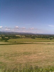
Beyond Hazor you enter the beautiful plain surrounding the now drained Lake Huleh or Waters of Merom. This malaria infested marsh was sold to Jewish settlers by its Arab owners early this century. The settlers worked very hard and drained the marsh, turning it into fertile farmland. In the process, of course, they destroyed the habitat of numerous wild birds and animals and recently there has been a proposal to allow at least part of the ancient lake to fill with water again in order to bring back the wildlife as a tourist attraction.
Naturally, as soon as the land was rendered productive, its former owners tried to take it back and were most offended when the Jews refused to leave and declined to be killed. (I have known British farmers who behaved in much the same way!) On the excellent principle that one Jew is as good as another, the offended Arabs went off and killed some innocent Jews elsewhere and the Jews responded in kind and thus, tit for tat, the area descended into bitterness and warfare.
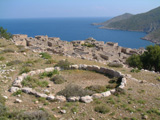
Banias, the Caesarea Philippi where Peter identified Jesus as the Messiah, is also the source of the River Jordan. The spring and the Grotto of Pan (Banias is a corruption of "Panaem") are quite picturesque and there is a pretty little waterfall near by if you have the time to walk to it. Look out for rock hyraxes which run wild around the spring. According to Eusebius, the woman healed of an issue of blood was from here and he claimed to have seen a statue of Jesus, erected in gratitude by this woman. It is no good looking for it, however, as it was destroyed by the emperor Julian the Apostate.
Recent excavations at Banias have not only cleared more shrines near the cave, but have found the remains of Herod's palace, which are quite impressive. It pays to be early here, for the place quickly fills up with Jews enjoying a day out - and the young of the species are not notable for their courtesy to strangers.
As you go down the hill from Banias take the first turn on the left and climb further up into the hills, heading for the fortress of Qalaat Nimrud, a massive Crusader castle crowning the hill-top on your left. Its imposing appearance exceeds its somewhat inglorious history, for it was captured by the Muslims barely three years after it was built and although the Crusaders re-captured it seven years later, it tamely surrendered to Nur ed-Din in 1164 because nearly all the Hospitaler garrison were absent, taking part in an abortive invasion of Egypt. The present remains appear to be all Muslim, however. It was more or less abandoned after it was captured by the Mongols, a thought to bear in mind as you wander round the impressive fortifications. The Mongols were so numerous that they more or less just flowed over the walls, despite the best efforts of the defenders!
Return to Banias and as you come down the fairly steep road from the source look for an overgrown tel on the right hand side of the road at the foot of the slope. This is Tel Dan, so if you have already been to Beersheba you have now travelled the full extent of the Promised Land.
Until recently, although the site had been excavated, there was nothing to see at Dan. However there is new work going on there which has uncovered a length of impressive stone wall, a large gate and, of course, the Dan Stele which confirms the existence of the "House of David". The tel is in a national park, so you will have to pay for entry.
Choose a suitable route across to Acre. On the way you may wish to visit Safed, a centre of Jewish studies. Nearby is one of the largest Crusader castles ever constructed. Signs point to the Birya Forest where you will find the grave of Jonathon ben Uziel. Anyone who prays at the grave will be married within two months. Doubters take the precaution of leaving little notes with their telephone numbers!
Other places to visit include Montfort, a Crusader castle, and Meron, which is some 8 miles west of Hazor, where the Jews still practice animal sacrifices. If you go along the border notice the contrast between the green of Israel and the barren Lebanese hills. At the coast you can visit Rosh Hanikra or the Ladder of Tyre, where you can drive right up to the Lebanon border and visit some fairly spectacular sea-side grottoes. Notice how the beach for some miles south is lined with street lights facing outwards, to deter sea-borne terrorists.
Acre has little significance for the Bible but was important in Crusader history. The fortifications built by Ja'azer the Butcher and which foiled Napoleon's plans for world domination are quite impressive, but even more so are the Crusader remains — the underground refectory of St John from which a low, narrow tunnel leads to a guard post in another part of the city entirely. This hidden passage may well have been a secret escape route down to the harbour. Hunt around until you find the plaque in memory of a British sailor who helped the garrison beat off Napoleon.
Down by the harbour and scattered throughout the old city are various khans or inns, which originally marked the headquarters of the different factions between whom the city was divided. Incredible as it may seem, Venetians, Genoese, Pisans, Templars and Hospitallers were more interested in fighting each other than in combining against the common enemy. Some streets feature houses deliberately built out of line like towers in a wall, in order to provide enfilading fire up and down the street.
Continue south to Haifa, where the only thing worth visiting is the golden-domed tomb of Bahai Ullah, the founder of the Bahai religion. It is interesting that he was a prophet around 1844 — a time when many Christians expected the return of Christ — calling Muslims to expect the Mahdi. Muslims, who believe that Mohammed was the last prophet ever, rejected him and he was eventually arrested by the Persians, hung by his wrists from the walls of the local fortress and shot. When the smoke of the firing squad cleared it was seen that the prophet had disappeared, which caused no little consternation until he was found calmly drinking tea in a guardroom - the bullets had done nothing more than cut the ropes which suspended him.
Some might feel that this was a clear indication of Divine favour, but the Persians simply hung him up again and this time took better aim. One cannot help but feel that if they had listened to the teachings of Bahai Ullah the world in general and Persia in particular would be a better place. Instead the Persians were condemned to follow another "prophet" - Ayatollah Khomeini - who preached bitterness instead of kindness, revenge instead of forgiveness, and harsh intolerance instead of toleration.
Photography inside the tomb is forbidden but the gardens (which close at noon) are beautiful and the view from the bottom of the hill looking up the gardens and stairways is quite spectacular.
Down at sea level find the insignificant Elijah's Grotto (where Elijah prayed for rain) at the tip of the headland and notice how close the mountain is to the shore. In ancient times it is possible that there was even less room between the two — the cliffs may have fallen directly into the sea.
Continue up the road out of Haifa hunting for signs pointing to Isfiya, Daliat el Carmel or Elyakin. These are Druse villages, distinguished from other Arab villages by the fair good looks of the children. Towards the end of his life the mad caliph Hakim, the man responsible for the destruction of the Holy Sepulchre, decided that he was a god, a secret he confided to some of his entourage. He was fond of long walks in the countryside outside Cairo and one day he went out for a walk in the Mokkatam hills and disappeared, an event which enhanced his claim to divinity.
Two Muslim mystics taught that al-Hakim was a manifestation of divinity and between them established the community now known as the Druze. Their religion, which has some gnostic and Manichaean elements, is based on the writings of one of these mystics. They look for the return of al-Hakim when they, under him, will rule the world.
The Druse are persecuted by Muslims on the grounds that their religion is not a recognised faith but a heresy from Islam. Following the old principle that "my enemy's enemy is my friend" the Druse sided with Israel against the Arabs, though recent events in the Lebanon have somewhat weakened the old alliance.
After driving about fifteen miles along the ridge of the Carmel range a road leads off on the left to the site of Elijah's sacrifice, known as Muhraka. This is undoubtedly as bogus as most other sites in the Holy Land but there is a dramatic statue of Elijah brandishing a sword and trampling on the prophets of Baal, and equally dramatic views from the roof of the church over the Valley of Jezreel below.
Continue along the ridge until you reach a main road where you should turn left. Notice how narrow and steep is the pass by which you descend to the Valley of Jezreel. Further east there is another, even steeper and narrower, pass. The Egyptian army, whose tactics depended a lot on the mobility of its chariot force, did not care to venture around the end of Mt Carmel, where they might be caught and swept into the sea. Instead, for thousands of years, they crossed one or other of these passes to the Valley of Jezreel and then followed the Rift Valley northwards. One of these passes, therefore, is where Josiah attempted to attack the Egyptians under Pharaoh Necho as he marched north to aid the Assyrians against the Babylonians.
Descend the pass and turn right along the Valley of Jezreel towards Megiddo. Tel Megiddo is unique among archaeological sites in that the excavators, backed by American money, intended not just to cut a couple of slices, but actually to remove the whole tel layer by layer. Fortunately they failed; the undertaking was just too big, even for Americans. Nevertheless they had a jolly good try and ruined large areas of the mound.
The science of archćology is continually improving as new techniques and methods are brought in. The trouble is, once a site has been excavated it is impossible to re-excavate it. You cannot say "Let's see what results we get if we apply this new technique?" The evidence is gone and all you are left with — if you are very lucky — are the excavator's reports. As he was unaware of this new technique or method he probably will have failed to record the very information that you need in order to assess or re-assess his work. Megiddo provides a perfect example of this problem.
At the ticket office make sure you have a good look at the museum, which has recently been improved no end with informative displays and models. In particular notice the model of the tel, created by the excavators. There used to be handles in the side which you could turn to wind sections of the model in and out. These have now been replaced by push buttons that work electric motors. I can't help but wonder how long it will be before they break down. (Answer: not long. On my last visit the buttons did nothing.)
The first thing you see as you climb up onto the tel is another six-roomed gate similar to the one at Hazor, which is believed to have been built by Solomon. Notice the sign claiming that grooves in the walls once held wooden beams - a feature said by the Bible to have been employed in the temple of Solomon.
Higher up you come to the stables, marked by stone mangers and tethering posts. At first these were thought to be Solomon's stables for his chariot city, as the Bible calls it, but when Yadin excavated the gate at Hazor he found it associated with a casemate wall whereas the Megiddo gate was associated with a solid wall. As he believed that both gates were built to the same plan this difference in the walls was puzzling, so he came to Megiddo and undertook a small dig in an unexcavated area. He was able to prove conclusively that the solid wall was built on top of a casemate wall and was later than the gate, which indeed belonged to the casemate wall. As the stables were clearly from the same level as the solid wall, this meant that they could not have been built by Solomon and are now believed to have been built by Ahab, who was also responsible for the stone-lined pit with double staircase that is thought to have been a grain store.
About halfway through your tour of the tel you will come to a deep excavation, where the diggers realised that their dream of clearing the whole site wasn't going to be fulfilled and concentrated on one part before the money ran out. The main feature of this is a large round "high place" that formed the central sanctuary of the Canaanite city. High places were often in the centre of the city, as, for example, when Saul met Samuel while out looking for the missing donkeys.
The glory of Megiddo is its water system. A huge pit with a spiral staircase, similar to the one at Hazor, leads down to a tunnel 120 feet below the surface, and eventually to the water supply. Originally this was approached down the side of the tel but that external entrance was blocked up to prevent an enemy getting at the water. Some of the blocking has been removed and the modern visitor, who has been dreading the trek back up the tunnel and staircase, emerges into sunlight to find, to his surprise, that he is at the bottom of the tel not far from where he left his car.
If you have the time, you might want to retrace your steps for a couple of miles and visit the catacombs of Beit Shearim, which were created around the tomb of Rabbi Judah ha-Nasi, the compiler of the Mishnah. At the time Jews were not allowed near Aelia Capitolina (Jerusalem) and so could not bury their dead on the Mount of Olives, hence the popularity of this alternative holy place. There are 31 catacombs, not all of which are open to the public. One catacomb, which was used in later times for a glass-works, has been turned into a museum.
From Megiddo take the road to Afula and thence to Nazareth. Near the top of the ascent, opposite the Nazareth Hotel, look out for a small deserted church on the right, standing in a field all by itself. This is the Church of Our Lady of the Fright, beautifully decorated with frescoes of gold stars against a dark blue background, but now abandoned and used as a fold for sheep and goats by local shepherds. Mary was standing on this spot when she saw Jesus being hustled out of town by the angry mob and naturally was frightened for His safety. An alternative tradition, propounded to me with great seriousness by a priest in the church (which then was open and flourishing), was that Mary thought she had caught a cold and was therefore frightened.
Look for the Virgin's Fountain, which is supposed to be the well from which Mary drew her water, genuine because it is the only one in town but now dry and unused. Behind it is a Greek Orthodox church built over the actual spring that supplies the fountain.
Further down the hill is the Catholic church supposedly built over the home of Mary and Joseph, with ancient ruins devoutly preserved in the church, a modern altar strategically placed so you can say mass on the very spot ... etc. To me the main attraction of the church are the ceramic representations of the Virgin presented by different countries, ranging from a slit-eyed Japanese maiden to one from Sweden or Norway or somewhere, so modernist and cubist in design that you are not sure whether the artist intended to represent the female form divine or an explosion in a Volvo factory.
Between the two you wander through the bazaar where you can do the traditional thing and photograph "the carpenter's shop". No doubt a picture of such a shop in Nazareth is very romantic and authentic; the trouble is that the carpenter is a very go-ahead, up-to-date sort of chap and his shop is bulging with bulky electric tools which entirely spoil the effect. Would that we could share the experience of Justin Martyr who records (Dialogue with Trypho 88) that when he visited Nazareth he saw some ploughs and yokes actually made by Jesus and Joseph. In his opinion, they were of very good quality and quite durable.
Somewhere in the bazaar, not far from the big Catholic church, is the Synagogue Church, supposedly the site of the very synagogue from which Jesus was cast out. The exterior is hard to photograph because of the smallness of the courtyard and the interior is not worth photographing, consisting of a plain, bare, empty room. If you can't find it (or more likely it is closed when you do find it) don't shed any tears or sit around waiting for it to open.
Not far from the centre of Nazareth is a "Nazareth Experience" or something of the sort. Although a worthy enterprise, making the best possible use of an acre of ground by crowding into it anything that might possibly call to mind a Bible story, it is really a waste of time and money when you are surrounded by the real thing.
From Nazareth you can go north to Kafr Kana, otherwise known as Cana of Galilee, a filthy Arab village whose only attractions are the two churches which both preserve the very stone jars whose water was turned to wine.
You now need to get across to Caesarea and the only place of any significance which you have missed is Tel Dothan, to get to which you would have to go back to Afula, then to Jenin, turn right towards Megiddo and the tel is on your left about four miles out of town. You can wander over the tel and find the very cistern in which Joseph was imprisoned (take your pick, there's enough of them) but unless you have plenty of time and are determined not to miss a thing the place is not worth a visit.
It might be interesting to go back to Megiddo and take the road over the Carmel pass, which is where Josiah was killed, then turn right along the coastal motorway to Caesarea. An alternative is to drive round the end of Mt Carmel and head south along the motorway. Look out for the ruins of Athlit, once an important Crusader port because, like Tyre, it had an offshore island that provided a protected anchorage. Unfortunately the ruins of the Crusader castle are within an Israeli naval base, so you cannot visit them.
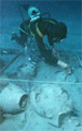
Caesarea used to be somewhat of a disappointment. The very impressive city walls are entirely Crusader, as are the visible remains of the harbour. The ruins inside the city are neither impressive nor intelligible, a jumble of Christian churches and Roman temples overlaid by centuries of dust and hordes of bewildered tourists. All Herod's marvellous engineering is underwater, but if you are into that sort of thing, it is possible to hire scuba gear and follow a marked underwater trail that will give you a guided tour of the foundations of the harbour and innumerable broken pots thrown overboard in antiquity.
Just to the south of the Crusader walls archaeologists from Drew University have discovered a Herodian underground chamber that was altered to form a Mithraeum in the 3rd century AD. This is the first Mithraeum to be found in Palestine. The walls of the chamber were decorated with religious frescoes and there was an altar that was lit by a shaft of sunlight every summer solstice. The usual circular medallion depicting Mithras slaying the primaeval bull was found, but I don't know where it is now.
Further south still is a much restored Roman theatre in which modern plays and concerts are produced, but the only thing worth photographing there is a fibreglass reproduction of the Pontius Pilate inscription. The original is in the Israel Museum, but photography is not allowed there, so be grateful for small mercies.
Just north of the theatre new excavations have uncovered a second hippodrome, this one by the seaside so that patrons of the single bank of seating could raise their eyes from the dust of the racetrack and look out at the blue of the Mediterranean. The excavations here are on-going and new things are being discovered every day. Unfortunately, this means that the explanatory signboards have not been put up yet, so all you will see is a jumble of broken stone walls that will not mean very much to you.
Return to the motorway and travel south to Jaffa-Tel Aviv, avoiding the horrors of Netanya, one of Israel's busiest and most garish resorts, then back to Jerusalem, if that is your base. On the way, however, you may like to call in at Tel Qasile, which can be seen from the motorway. It is located on the outskirts of Tel Aviv, near the University Campus, just to the north of the Yarkon River. (It is only open in the morning, Sunday to Thursday.) Excavators here found a Philistine temple whose roof was held up by two wooden pillars within arm's length of each other (shades of Samson) and a small golden calf which is now in the Israel Museum. There is also a reconstructed Philistine house in the museum. My father, who excavated on this site, makes the somewhat tongue in cheek claim that the house is that of Samson's Philistine wife, for the skeletons of a man and a woman were found in a layer of ash. Unfortunately Tel Qasileh is not the best known site and you are likely to have considerable trouble finding it.
On the way up to Jerusalem look out for the ruined armoured cars and trucks on the left-hand side of the road just after you enter the hills. These date from 1948, when a Jewish convoy taking relief up to Jerusalem was ambushed by Arabs and destroyed, and have been left here as a memorial. They have recently been moved into the central reservation of the motorway and mounted on concrete plinths. It is nice that they are being preserved, but a shame that they no longer evoke the violence of the ambush and are as meaningless as any other war memorial.