Google Earth and the Fraudsters
Google Earth is a wonderful invention - a program that allows you to start somewhere way out in space and seamlessly zoom in on your chosen location on earth until you can actually see whether your car is parked in the drive at home. (Unfortunately the pictures are not real time and in some cases can be several years out of date.) Best of all, the program is totally free and can be downloaded onto your computer without costing you a penny to either install or use.
The latest version of the program even allows you to strip away the surface of the ocean and look beneath the waves at the sea floor. You don't get to see any coral or great white sharks cruising off your favourite beach, but you do get a reasonably accurate picture of contours beneath the surface.
Now there is a new use for this amazing program: exposing the fibs told by a man called Ron Wyatt (and by others who have jumped on his profitable bandwagon).
Ron was a nurse in what should have been a satisfying and fulfilling job, but instead he got into the business of finding places mentioned in the Bible. In itself, that is a respectable activity: nineteenth century scholars and travellers did sterling work using ancient documents and Arabic place names to identify Biblical sites such as Gezer, Gibeon and Gath. Most of their identifications have been confirmed by archaeology, though a few have had to be revised as more information comes to hand.
Ron, however, was not into locating lost cities or buried ruins: he claimed to have discovered the places where some of the Bible events happened - the crossing of the Red Sea, the destruction of Sodom, the hiding place of the Ark of the Covenant, and so on. Furthermore, instead of relying on tedious study of ancient literature or the clues in Arabic placenames, he claimed to be guided by Divine inspiration - which puts him on a par with Joseph Smith, treasure-hunter and Mormon founder, or Edgar Cayce, self-proclaimed communicator with dead pharaohs.
Two of his claims can be examined - and debunked - using Google Earth.
The first is the claim that the Children of Israel crossed the Red Sea near Nuweiba. This claim is debunked in a film which I made for NWTV a couple of years ago when I was in Egypt and which you can view. (Click on either "Parting" or "Broadband", depending on the speed of your internet connection.)

|
| This picture comes from the Wyatt Museum website, as referenced opposite. |
The basic message of the film is that Ron Wyatt claims that there is a shallow land bridge just beneath the surface of the waves opposite Nuweiba, across which the Children of Israel walked to escape from pharaoh's army. You can see a picture of how Ron imagines this bridge, which the accompanying text tells you is 30km wide. I rubbish this claim by flourishing a map from the British Admiralty which shows that the shallowest part of the gulf in this area is 765 metres deep!
However it's all very well me waving a map at the camera: for all you know I may have drawn that map myself using felt-tip pens just before filming, so start up your copy of Google Earth and make sure that it is the latest version (the version I am using to write this article is 5.0.11733.9347 - basically, version 5). Zoom in on the eastern arm of the Red Sea, the Gulf of Aqaba or just type "Nuweiba" into the search box labelled "Fly to" at the top left. You will have to zoom in (or out) a bit so that you can see both sides of the gulf on your screen.
Next check in the "View" menu and make sure that the "Water Surface" option is not ticked.
Ron claims that this bridge extends from the bulge just below what Google Earth labels as "Nuweiba" and marks with cross hairs, to a small bulge on the opposite side of the gulf. Run your mouse over the sea and notice a line at the bottom of the screen where numbers change rapidly. The first set of numbers is your degrees north (or south, if you happen to investigate Australia) the second is the degrees east or west. The third set is elevation, which will be positive while you are over land but which becomes negative as you cross the sea. (Notice that you can set it to feet or metres by using the "Options" in the "Tools" menu.)
You can move your mouse anywhere on the screen and zoom in and out while you see for yourself whether Ron Wyatt's claim of a maximum depth of 20m is correct or whether I am telling the truth as I flourish the map.
Now hold down Shift and press the Down arrow. The whole map will tilt, giving you a 3D perspective of the world. All relief maps have a degree of exaggeration, as otherwise the highest mountains appear insignificant against the scale of our world. Again, you can control this exaggeration using the "Tools -> Options" menu: I have mine set to 1.5, but if you are a stickler for accuracy you can choose 1 or go wild and have 3!
You will find yourself looking along the floor of the Gulf of Aqaba. Note the complete absence of a land bridge - which you can confirm by using the Up arrow on its own to move forward over the sea. Then use Shift and the Left or Right arrow keys to rotate the map and look along the sea bed in the opposite direction.
Still no land bridge. It would appear that Ron Wyatt and his museum are pulling a bit of a fast one on the public with this claim, but things get better and better.

|
| This picture is from the Wyatt Museum website referenced opposite. |
The same web site shows a picture of a pillar which, they claim, was erected by Solomon to mark the site of the crossing. You can find a better picture of it on another supporter's website - click on the picture to enlarge it. Allegedly this is a "Phoenician-style" pillar.
To be honest, I don't have a clue what a "Phoenician-style" pillar would look like. I have explored Tyre, Sidon and Byblos, the three great Phoenician centres, and don't recall pillars in any of those places. The closest to a pillar is in the "Obelisk Temple" at Byblos, but as those standing stones didn't support anything they don't really count as pillars. However before you close down that picture of Ron's pillar, have a good look at the top of the pillar and notice the lip around the top edge.
Now type "Beit She'an" into the search box on Google Earth. Make sure that in the "Layers" panel on the left of the window you have "Geographic Web" and "Panoramio" both ticked. If you have, you should see a mass of blue-and-white rectangles a short distance south-west of the cross-hairs that mark "Beit She'an"; these are photographs that people have uploaded.
Run your mouse over these rectangles and off on the left you will come to one that opens out into three rectangles, one of which is labelled "Beit Shean, Western Bath House, Columns". These are Roman columns. Have a look at the pillars just below the fancy capitals and you will see exactly the same lip as is displayed on the alleged "Phoenician-style" column at Nuweiba.
In other words, what Ron has found is nothing to do with Solomon or the Red Sea crossing; it is a Roman pillar, probably from a long-vanished temple or villa that stood here in the time of Christ. Ron claims that the inscription Solomon made on this pillar has eroded away and the corresponding inscription on another pillar the other side of the gulf has been removed by the Saudi authorities. How convenient!
Remember: these are not my maps, they are not my "Divinely-guided" discoveries, they aren't even my photographs. These are not attempts to deceive the public by putting up false information and, above all, I don't get any money out of drawing these facts to your attention. You can decide for yourself who is making money through false claims and by deceiving the public.
However we are not finished with Ron.
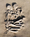
Another of his claims is that he has discovered the ruins of Sodom near Masada. He goes on about thick layers of "ash" impregnated with globules of sulphur and how this "proves" that the ash is that of Sodom, for, after all, God rained down fire and brimstone on the corrupt "cities of the plain", so naturally we would expect to find brimstone - sulphur - in abundance.
You find photographs of Ron's discovery in various locations on the internet, but this reference will take you to the site of one of his supporters which has the photographs that the official Wyatt Museum is too cute to display. (Mind you, even this website doesn't dare to give you large pictures of these "walls" and "windows", presumably because the imposture would be too hard to maintain in high resolution, what with their talk of Egyptian sphinxes mixed with Mesopotamian ziggurats!)
Type "Masada" into the "Fly to" box and choose the last of the options - the others are up in Galilee somewhere - which will take you to the famous fortress down by the Dead Sea. Zoom out to an "Eye alt" of about 44,000 feet (you can find this figure down on the bottom right of the Google Earth window).
Notice that there are several patches of white in the picture to the east of Masada. There are two large fan-shaped patches between Masada and the north-south road and it is these which Ron claims are the remains of Sodom.
Drag either one into the centre of the window and then zoom in. As you do so, notice that the white stuff, whatever it is, has been eroded into channels and gullies. These are not city streets, but typical natural water erosion channels.
When you get to around 8,000 feet "Eye alt" you will see two blue-and-white squares in the middle of the southern area of white. They have no name, but click on them and then compare what you see with the pictures on the Wyatt site above. There is another one labelled "Judean desert" in the northern area of white.
As you can see from the aerial view, these formations are entirely natural and have nothing to do with Sodom or any other man-made construction. Even more damning - but, unfortunately, not visible on Google Earth - is the fact that there is no pottery to be found in this alleged "city".
Any ancient site is thick with pottery - and even Divine fire will merely bake the pottery harder, not destroy it. Pots don't turn to ash - mind you, neither do mud bricks, which end up baked a bright cherry red. There is no pottery visible either in the Panoramio pictures and I can assure you that there is none on the ground if you visit in person.
As for the sulphur globules, Dr Nick Milton of Aberystwyth University (he is a Christian but may be retired now) told me that such things are common in certain sedimentary settings and are probably made by bacteria that accumulate sulphur in their bodies. The sulphur originates in the tectonic activity that caused the Great Rift Valley and there are actually sulphur springs along the shores of the southern Dead Sea. The output of these springs is used to make sulphur soap for the masochistically inclined - I can't imagine that it brings you up lovely and sweet smelling!hat
Of course, if Ron and his cohorts are telling fibs in these two matters - as I hope you are now convinced is the case - then it means that the rest of their claims must be considered highly doubtful at best, if not outright false (which is what I believe). Unfortunately it is not possible to claim that he may have been an honest man who was mistaken: he has made such bold claims which are so egregiously wrong that a mere mistake is not an adequate explanation. Deliberate deception in order to extract money in the form of sponsorships and sales of books, DVDs and magazines, is, in my opinion, the true reason for his actions and the continuing deceptions of those who follow him.
© Kendall K. Down 2009